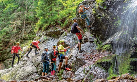

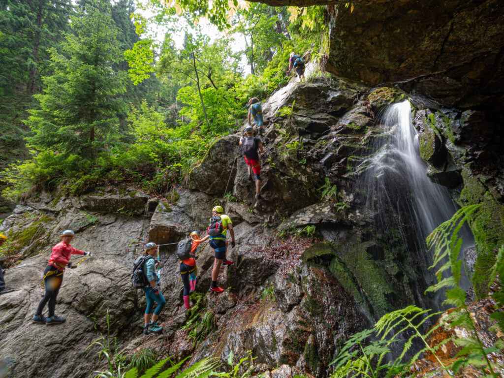
Ferrata HZS:
Martin - Pivovarský potok - Martinské hole - Martin
Krivanska Mala Fatra:
Šútovo - Šútovo waterfall - Šútovo
Veľká Fatra:
Thick and Sharp
Ascent to Lysec
Ascent to Katova skala via Teplice serpentines
The territory of Turiec extends in the naturalthe largest basin surrounded by the Veľká Fatra, Malá Fatra, Kremnické vrchy and Žiar. The axis of the basin is formed by the river Turiec.
Great Fatra
It extends in a north-south direction from Ružomberok to the Malý Šturec saddle. Almost the whole main ridge has a hilly character. Excellent vantage points on Krížna (1574 m), Ploska (1532 m), Borišov (1509 m) and Rakytov (1567 m) offer idealtours with the possibility of accommodation in huts at the King's Well, Cottage under Borišov, Smrekovice and Malin Brda.
Gaderská dolina and its continuation Dedošvalley is considered to be one of the mostof the largest valleys in Slovakia.The section from the Necpalska valley to Žarnovická toThe flax is particularly valuable from a botanical point of view. The flora of Tlstej (1414 m) is particularly rich, of a beautiful rocky limestone peak
Little Fatra
One of the most beautiful mountains in Slovakia. Vynára from the Žilina and Turčianska basins as a mighty mound, arching in an undulating arc from Klyak to the northeast to Rozsutec. At Domašín is crossed by the meander of the Váh and divided by into two separate parts: the southern part - the Lucian part with a large and wide central gamebeno, the northern - Krivan part with gracefully wavy sharp ridge.
Main tourist centres in summer and winter period are the valley Vrátna, Martinské hole and Fačmetal saddle. The densely populated foothills abound in rich cultural monuments, manor houses and castles. Unforgettable are the views from RozSutec (1610 m), Veľký Kriváň (1709 m), Veľká lúka (1475 m) or Kľak (1351 m).
Tourist destinations:
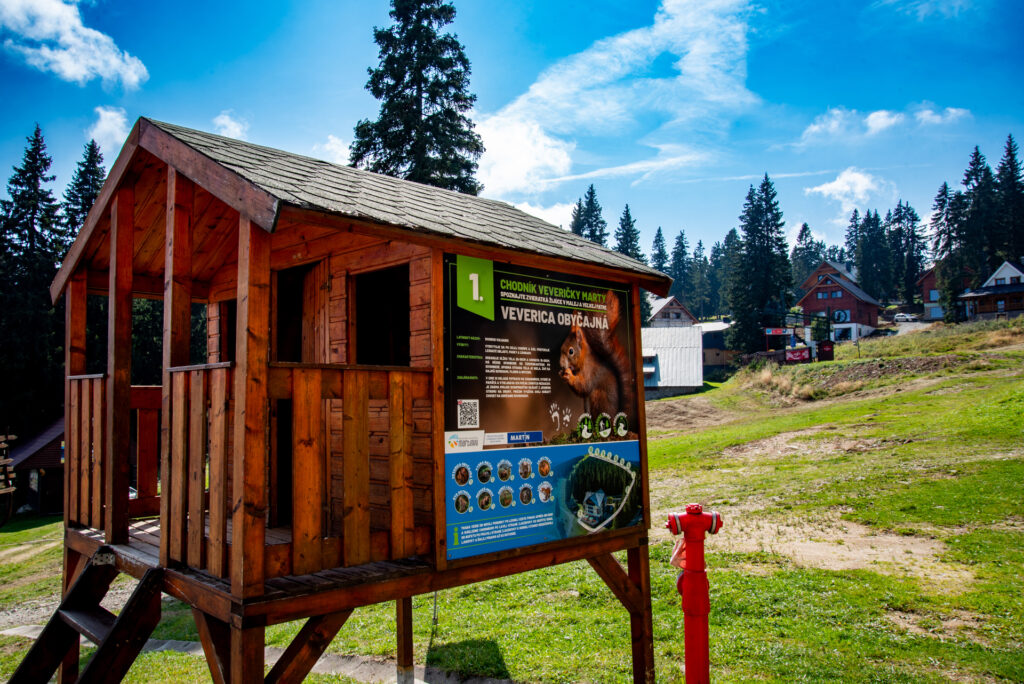
Jasenská dolina, Snowland - Valčianska valley, Martinky - Martinské hole, Révajov-the park in Mošovce, Klačianska Magura, Veľký Kriváň, Ostrá, Tlstá, Chleb, Gaderská valley, Blatnická valley, Necpalská valley, Kláštorské meadows, Turčianska magistrála, Šutov waterfall, Borišov, Lysec, Drienok, Lookout tower on Krahulský štít.
Castles:
Sklabinsky, Blatnicky, Znievsky
Waterfalls:
Shutovsky
Mountain huts:
Kľačianska Magura, Chleb, Borišov, Martinské sticks, Ravenovo
Route
Martin, Stráne - Ferrata HZS, boarding - Ráztoka - Martinské hole - Martin, Stráne
Route length: 12.3 km
Elevation: +785 m, - 785 m
Time commitment: 4:20 p.m.
Attractions
Brewery Creek Canyon, waterfalls and cascades of the creek. Educational trail about the biodiversity of the local mountains, demonstrations of old mining techniques

Route description:
The HZS ferrata can be reached from Martin from the final stop of the public transport bus at Stráňy along the Pivovarský brook to Martinské Hole. The lower part is two-way, suitable for families with children, the upper part is technical, one-way, only from the bottom to the top, for more skilled hikers. It is set in the canyon of the Pivovarský brook, its upper part is divided into variant B (easier) and variant C (harder variant). Both routes B and C meet at 1250 m above sea level. Then the trail continues for 10 minutes and connects to the blue trail, which will easily take you to the huts on Martinské Hole. From there it is also possible to climb to the highest peak of Lúčanská Mala Fatra - Veľká Lúka. The return from the ferrata is from Martinské Hols along the yellow trail to the starting point - the public transport stop, Stráne.
The nature trail and ferrata are only open from 1 June to 14 September and from 1 November to 14 April. A ferrata kit is recommended - helmet, harness, fall absorber, gloves.
Route options:
1. About halfway through the output it is possible to disconnect out of the red marker and continue on the Par-Tizan cannon "Hodinovka"(2h), or to Martinské Hole on the yellow (3,5h), you will bypass the team stretch where you need to belay, suitable for families with smaller children.
2. After the refreshment on Martinské holy is it's only 30 minutes to the transmitter Krizava, where the connect to the red marker that leads the mainthe ridge north to Minčol (1h 10min).
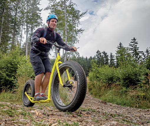
3. Downhill (7km) on off-road scooters on the way back.
Route
Šútovo - Šútovo waterfall - Mojžišové springs - Chata pod Chlebom - Šútovo
Route length: 15 km
Elevation: +1030 m, - 1030 m
Time commitment: 6 hrs.
Attractions
Šútovský waterfall, the largest waterfall - it is 38 m high and the largest in Mala Fatra The nature trail in the Šútovská valley, which provides information about the Mala Fatra National Park, flora, fauna and forests

Route description:
The route to the Šutov Waterfall is easy, ideal for families with children. The trail starts on an asphalt road, with the Šútovský brook flowing on the right. It continues on through the forest to the Waterfall Cottage with refreshments. From the cottage, the trail continues another 3 km to the Šútovský waterfall, which is the largest in Mala Fatra and one of the most beautiful in the whole of Slovakia. More fit hikers can continue from the waterfall up the steep path to the Mojžišovy springs (1140 m) and from there to the cottage under Chleb and the main ridge of Mala Fatra. You can get back by the same path or by the green marked trail.
Route options:
Šutov Waterfall and back (8,6 km, +-315m, 2:20h)
Route
Blatnica - Vápenná dolina - Tlstá - Ostrá - Muráň - Konský dol mouth - Blatnica
Route length: 16.4 km
Elevation: +1058 m, - 1058 m
Time commitment: 6:40 a.m.
Attractions
Blatnicka valley, Blatnicka castle, Blatnica memorial, Tlstá, Ostrá, Mažarná cave.

Route description:
A difficult, challenging and long route with a steep ascent. Orientation is easy. Increased caution is needed on steep slopes, especially in the rainy season. Like all hikes in the mountain part of Veľká Fatra, it is one of the most attractive and eye-catching hikes with enchanting views of the Turčianska basin and the whole ridge of Veľká Fatra. From an altitude of about 700 m, high rock terraces and mighty cliffs rise, which can be seen from the Turčianska basin. One of the largest caves of Veľká Fatra - Mažarná - is located here. The interior of the Mažarná cave is not open to the public, so tourists have to be satisfied with admiring its magnificent entrance portal.
Route options:
1.Blatnica - Vápenná dol. - Tlstá - Muráň - Konský dol mouth - Blatnica. (13,4 km, +-915m, 5:50h)
2. Blatnica - Juriašová dol. Ustie - Ostrá - Muráň - Konský dol ustie - Blatnica(13,2 km, +-850m, 4:55h)
Route
Cottage Lysec - Lysec - Medzijarky - Kašová - Cottage Lysec
Route length: 11.7 km
Elevation: +841 m, - 876 m
Time commitment: 4:40 hrs.
Attractions
Lysec Peak - the dominant peak in NP Veľká Fatra, with views of the peaks of Veľká and Mala Fatra .

Route description:
Moderately difficult hike. It starts in Jasenská valley near the Lysec cottage. From the cottage trail climbs steeply up through the forest to the top. Vrchol is suitable for a break, refreshments and enjoy the panoramic views. From the top, follow the yellow trail down to the a place called "Under the Medzijarkami". From here we will go back down the green trail to Jasenská valleys - Kašová.It is also possible to start the hike in the village of Bela-Dulice from the bus stop. Follow the blue sign after about an hour we arrive at the Lysec hut, where begins the ascent to the top. And the same after thevrate to Kašová along the same route can be get for approx. 40 minutes to the village of Bela-Dulice.
Route options:
Kašová - Lysec - Malý Lysec - Jarabiná- Mažiarky - Cottage Lysec - Kašová(22,9 km, +-1530m, 8:20h) challenging hike for demanding tourists
Route
Turčianska Štiavnička - Teplice serpentines - Katova skala
Route length: 12 km
Elevation: +400 m, -400 m
Time commitment: 3 Throw.
Attractions
Mausoleum of the Révay family, the birth house of Jan Kostra, Slavic idol, Sklabin castle - ruins, Sucian castle - archaeological site

Route description:
Teplice serpentines (after the Teplica hill) are a very attractive place for tourists. The dense forest, mountain lakes and gurgling water, together with the fact that it is a relatively little known and visited place, create a real oasis of peace. The starting point of the hike to the serpentines is a gazebo with a mineral spring (honeydew) by the road at the southern end of Turčianska Štiavnička. The trail that passes through the site is unmarked, but clearly visible. Its crossing is not difficult, even families with children can manage it without any problems. At the top on the right there is a viewpoint on the rock and on the left along the forest path, traversing the massif of the Dvoriská hill and Katova skala, you will reach the ridge by the final steeper pass and in a moment you will be on the red marker, which will lead you to the very edge of Katova skala.
Route options:
Kašová - Lysec - Malý Lysec - Jarabiná- Mažiarky - Cottage Lysec - Kašová(22,9 km, +-1530m, 8:20h) challenging hike for demanding tourists
Crossing the Krivanska Mala Fatra:
Strečno - Chata pod Suchým - Suchý - Malý Kriváň - Veľký Kriváň - Chata pod Chlebom - Šútovo
Overnight accommodation options:
Cottage under Suchý
tel..: +421/(0)918 523 200
www.chatapodsuchym.sk
Cottage Klačianska Magura
tel..: +421/(0)907 338 871, +421/(0)905 766 650
www.klacianskamagura.sk
Cottage pod Chlebom
tel..: +421/(0)905 861 042
www.chatachleb.sk
Crossing the Great Fatra:
Horný Harmanec - Kráľova Studňa - Krížna - Ostredok - Ploská - Chata pod Borišovom - Ha-vranovo - Bela-Dulice
Overnight accommodation options:
Mountain hotel Kralova Studna
tel..: +421/(0)911 827 079, +421/(0)903 827 079
www.kralovastudna.com
Cottage under Borišov
tel..: +421/(0)905 729 959
www.chatapodborisovom.sk
Cottage Havranovo
tel..: +421/(0)905 792 671
www.chatahavranovo.sk
Practical and general information
Emergency line 112
Rescue service 155
Police 158
Firefighters 150
Municipal police 159
Mountain Rescue Service 18 300
Rail/bus transport www.cp.sk
Farrat set rental 0907 202 396
Information centres
Tourist Information Office of the City of Martin
www.tikmartin.sk
Tourist and information centre of the town Turcianske Teplice
www.turciansketeplice.sk
Information centre Jased Jasenská dolina
www.jasenskadolina.sk
Snowland Tourist Information Office Valčianska valley
www.snowland.sk
Sport Markovic
+421 43 422 3000, office@sportmarkovic.sk
MAX Sport
+421 911 927 888, jurbankova@mail.t-com.sk
Ing. Mária Kováčová - UNISPORT Kováč
+421 903 540 717, unisport.kovacova@stonline.sk
Cyklotrend Chalúpka
+421 915 433 579, cyklotrend@gmail.com
TR-bike, Horné Rakovce 1447, T. Teplice
+421 905 643 771
Rest areas for cyclists
(Tuřcian lookout towers)
Pod Bokšínom - Trebostovo, Pri Tankova ceste - Bystrička, Na Kalníku - T. Jaseno, Na Tŕní - Bela, Na Brotnici - Necpaly
Farrat set rental - 0907 202 396
Bicycle/e-bike rental - 0917 175 738
Explore Turiec through our Instagram account
Don’t forget to follow us at @turiecgo and tag us in your posts to be featured on our page! #turiec #regionturiec
Turiec Regional Tourism Organisation
S. H. Square Vajanského 1
036 49 Martin
ID : 42220360
VAT : 2023703704
Tel..: +421 915 551 377
Email: kancelaria@turiec.org


Realized with financial support of the Ministry of Transport of the Slovak Republic
| Cookie | Dĺžka trvania | Popis |
|---|---|---|
| cookielawinfo-checkbox-advertisement | 1 year | Set by the GDPR Cookie Consent plugin, this cookie is used to record the user consent for the cookies in the "Advertisement" category . |
| cookielawinfo-checkbox-analytics | 1 year | Set by the GDPR Cookie Consent plugin, this cookie is used to record the user consent for the cookies in the "Analytics" category . |
| cookielawinfo-checkbox-functional | 1 year | The cookie is set by the GDPR Cookie Consent plugin to record the user consent for the cookies in the category "Functional". |
| cookielawinfo-checkbox-necessary | 1 year | Set by the GDPR Cookie Consent plugin, this cookie is used to record the user consent for the cookies in the "Necessary" category . |
| cookielawinfo-checkbox-others | 1 year | Set by the GDPR Cookie Consent plugin, this cookie is used to store the user consent for cookies in the category "Others". |
| cookielawinfo-checkbox-performance | 1 year | Set by the GDPR Cookie Consent plugin, this cookie is used to store the user consent for cookies in the category "Performance". |
| CookieLawInfoConsent | 1 year | Records the default button state of the corresponding category & the status of CCPA. It works only in coordination with the primary cookie. |
| elementor | never | This cookie is used by the website's WordPress theme. It allows the website owner to implement or change the website's content in real-time. |
| Cookie | Dĺžka trvania | Popis |
|---|---|---|
| _icl_visitor_lang_js | 1 day | This cookie is stored by WPML WordPress plugin. The purpose of the cookie is to store the redirected language. |
| wpml_browser_redirect_test | session | This cookie is set by WPML WordPress plugin and is used to test if cookies are enabled on the browser. |
| Cookie | Dĺžka trvania | Popis |
|---|---|---|
| CONSENT | 2 years | YouTube sets this cookie via embedded youtube-videos and registers anonymous statistical data. |
| Cookie | Dĺžka trvania | Popis |
|---|---|---|
| VISITOR_INFO1_LIVE | 5 months 27 days | A cookie set by YouTube to measure bandwidth that determines whether the user gets the new or old player interface. |
| YSC | session | YSC cookie is set by Youtube and is used to track the views of embedded videos on Youtube pages. |
| yt-remote-connected-devices | never | YouTube sets this cookie to store the video preferences of the user using embedded YouTube video. |
| yt-remote-device-id | never | YouTube sets this cookie to store the video preferences of the user using embedded YouTube video. |
| yt.innertube::nextId | never | This cookie, set by YouTube, registers a unique ID to store data on what videos from YouTube the user has seen. |
| yt.innertube::requests | never | This cookie, set by YouTube, registers a unique ID to store data on what videos from YouTube the user has seen. |